2.4 km
Bandra-Worli Sea Link
Location
Worli’s Golden Triangle, as written in the brochure, is not only the Bandra-Worli Sea Link, Mahalaxmi Racecourse, and Worli High Street. It is living at the epicentre of connectivity, with South Bombay described as within reach.
Distances below are printed on the project connectivity map. Travel times are not stated except the marketing headline “All of Mumbai within 30 minutes,” which is brochure copy, not a timed guarantee.
Bandra-Worli Sea Link
Worli-Sewri Connector (as labelled)
Eastern Express Highway
Mahalaxmi
Western Express Highway
Cuffe Parade
Domestic Airport
International Airport
Also shown on the map without a printed distance: Coastal Road, Atal Setu, and Navi Mumbai Airport.
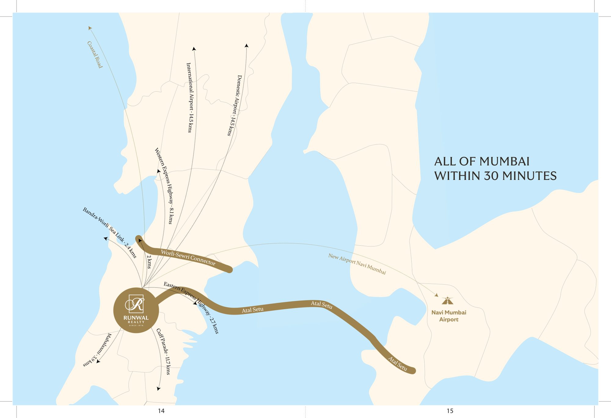
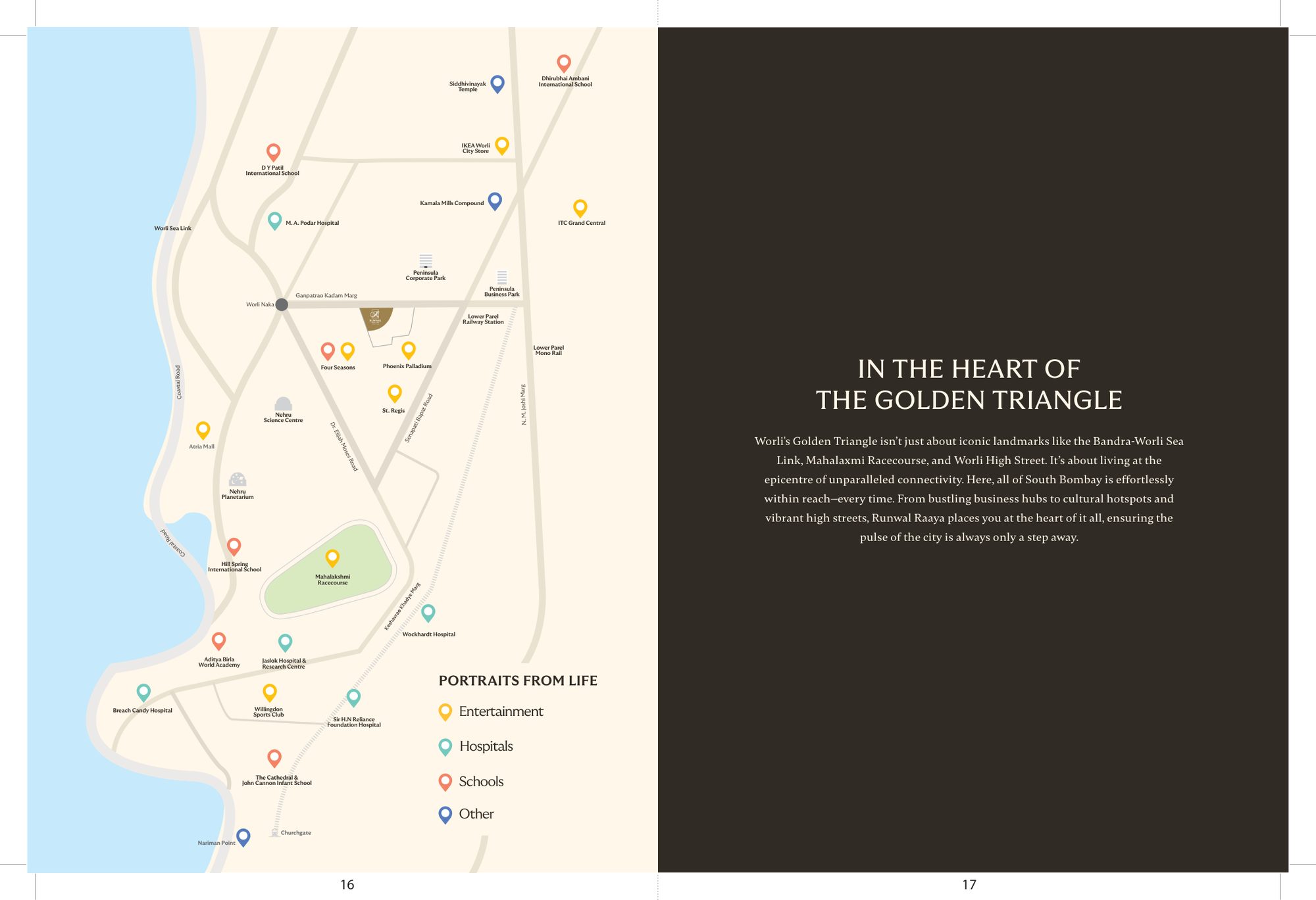
Maps are from the project brochure and are indicative.
Phoenix Palladium, Atria Mall, IKEA Worli, Kamala Mills, Nehru Planetarium, Mahalaxmi Racecourse
Peninsula Corporate Park, Peninsula Business Park, Lower Parel
St. Regis, Four Seasons, Willingdon Sports Club, ITC Grand Central
Lower Parel Railway Station, Lower Parel Monorail, Worli Naka
Sir H.N. Reliance Foundation Hospital, Wockhardt Hospital, Breach Candy Hospital, M. A. Podar Hospital, Jaslok Hospital & Research Centre
D Y Patil International School, Aditya Birla World Academy, The Cathedral & John Connon Infant School, Hill Spring International School, Dhirubhai Ambani International School